For Economic Evaluation of Capital Projects
The Hanover Engineering Land Use Planning Model is a customizable model developed for our clients that allows both us and them to make economic evaluation decisions based on local and regional demographic, environmental, and logistic data analysis.
- Real-Time Project Management
- Site Selection and Evaluation
- Multiple-Site Economic Evaluation Module
- Document Storage and Management
- Project Permit Schedule Analysis
- Visualize Development Potential
- Identify and Quantify Environmental and Project-Specific Logistic Cost Benefits
- Post-Construction/Commissioning (Operations/Maintenance Records Throughout the Life of the Asset)
SITE SELECTION ANALYSIS
- Land Use
- Zoning
- Traffic
- Transportation
- Utilities
- Environmental
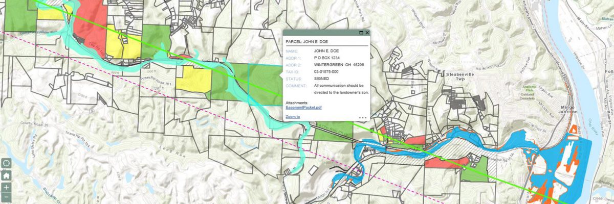
- Easements
- Demographics
SPECIALIZATIONS
- Enterprise GIS/Database Management
- Data Collection, Creation, and Integration
- Project Management
- Customized Applications
- Cost-Benefit Analysis
- Permit Matrix and Schedule
SUPPORT SERVICES
- Title Specialists
- Land Agents
- Easement Acquisitions
- Conservation Easements
- Acquiring Land
- Land Rights
- Wetland Mitigation
- Permitting
Example Customizable Model
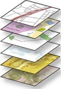
Models Automate Analysis Processes
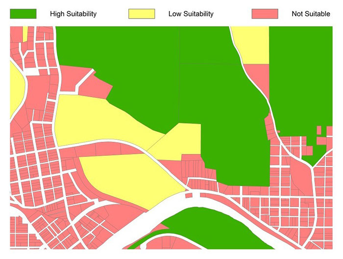
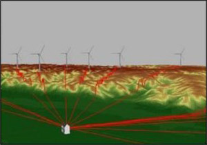
Wind Farm and Solar Panel Site Selection
Evaluation Criteria
- Distance to Road
- Population Density
- Wind/Solar Potential
- Proximity to Transmission Line
- Slope Analysis
- Exclusionary Areas
- Viewshed Analysis
- Client Variable
We combine your proprietary information and selection parameters with publicly available data to create a cost-effective economic evaluation model that allows a higher-resolution decision-making process.