Hanover Engineering was contracted to create a suite of maps and data collection tools for the Township of Chippewa in Beaver County. The township was interested in a comprehensive set of maps available to assist the municipal staff with day-to-day operations, as well as provide information and services to its residents.
Custom digital data and mapping tools were designed for desktop, mobile, and tablet usage. These tools were based on discussions with the township staff, and were tailored to their specific needs and requirements. The tools are convenient and easy to use, requiring no advanced knowledge of the GIS mapping software and only a minimal amount of training. Specific maps and data collection tools, and their access status, include:
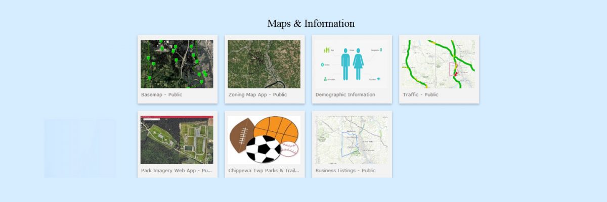
- Current Traffic & Road Closures: Public Use
- Demographics: Public Use
- Park Imagery Map: Public Use
- Parks & Trails Map: Public Use
- Zoning Map: Public Use
- Township Base Map: Public & Internal Use Versions
- Business Listings: Public & Internal Use Versions
- MS4 Collections: Internal Use
- Sign Inventory: Internal Use
- Supervisor’s Map: Internal Use
- Code Enforcement: Internal Use
- Permit Tracking: Internal Use
- Mailing Label Generator: Internal Use
The main purpose of these public maps is to provide easily accessible information from the township’s website directly to its residents. This will reduce the number of questions and calls the township receives and allow them to devote more time to other township business.
The internal web maps were designed with productivity in mind. The township was eager to increase the efficiency of their departments by digitizing workflow. They also focused on mapping the infrastructure they are responsible for maintaining within
the township.